I created this lab during the summer when tropospheric ozone is really high in the Los Angeles area. I used ozone test strips from Carolina Biological and took pictures at various times of the day, near freeways and away from freeways. You can purchase strips from the link below or from Carolina.
I normally cover air pollution in the winter when we typically do not have much ozone AND we are a few miles from a freeway. This means no readings or hardly any readings on the test strips. So, I made this picture lab a few years ago for students as an inquiry way to figure out ozone patterns. It also saves a lot of money as test strips are expensive.
The best option for teachers is to make your own lab taking pictures in your area, because research shows student learn best with local data. But, hey, teachers have limited time so feel free to use my lab created in the Los Angeles area. My city is a suburb of Los Angeles and I often drive down to LA for museums, restaurants etc.
Here are the links to the lab:
Pictures that can be uploaded to Google Classroom for student use or printed in color.
Student worksheet for the lab.
Some hints if you use this lab and are not in the Los Angeles area:
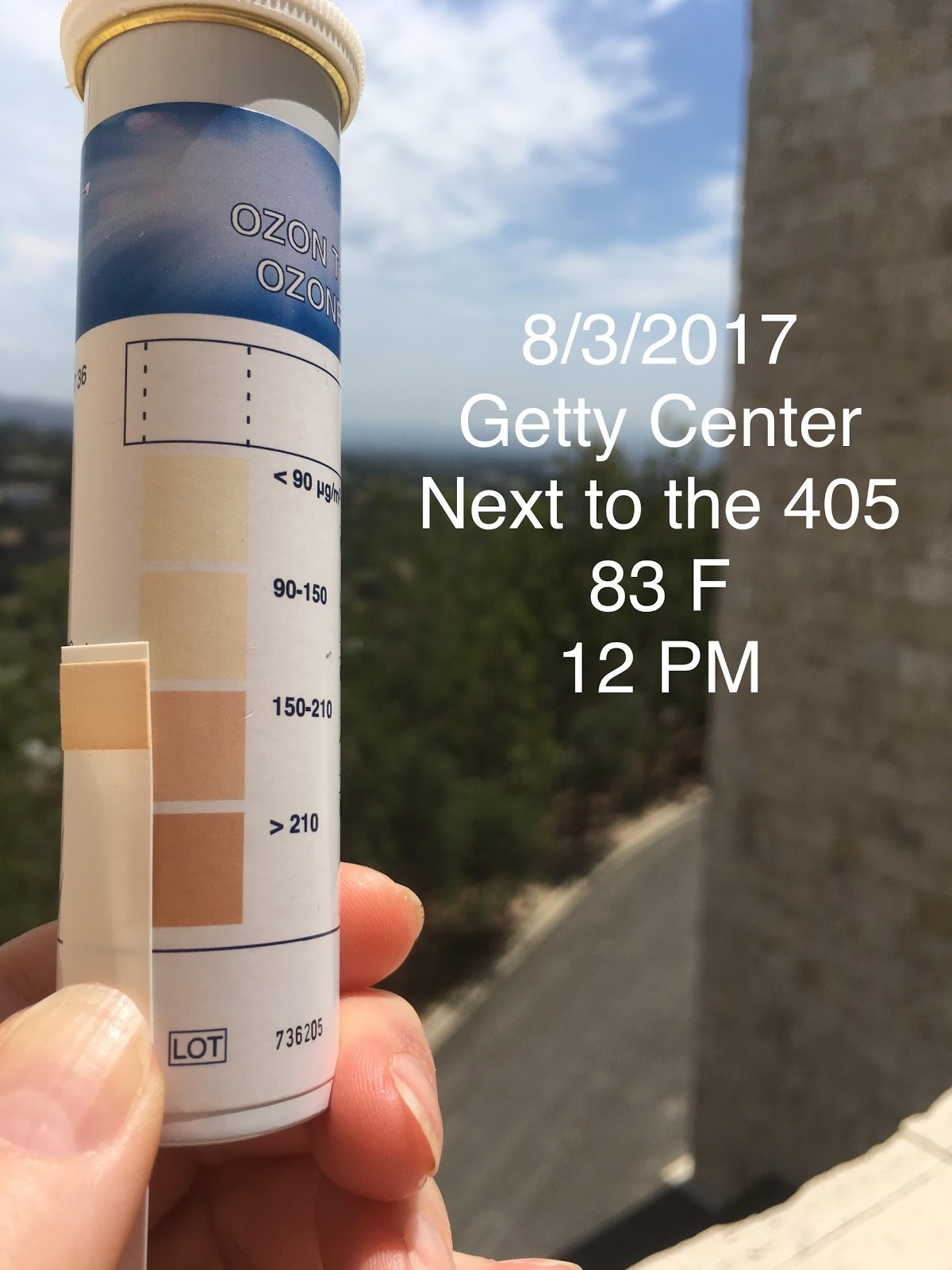
–The Getty Center is a famous art museum located next to the very busy Interstate 405 freeway in Los Angeles. It is near Hollywood.
–SCV is the Santa Clarita Valley, our school location.
-#15 on the lab paper: Our city , Santa Clarita, is located between the 5 and 14 freeways. Interstate 5 travels from Mexico to Canada and is heavily used–about 10 lanes going though our town. The 14 (state highway) is less traveled and only about 6 lanes wide.
* AP® is a trademark registered and/or owned by the College Board which was not involved in the production of, and does not endorse this site.
5 thoughts on “Tropospheric Ozone Virtual Picture Lab”